臺灣山林復育協會《三義火炎山生態之旅紀實》2017/09/24
Taiwan Reforestation Association《Miaoli Sanyi Huoyanshan Nature Reserve Ecological Trip 2017/09/24 》
大肚山的天然林早在100多年前,被破壞殆盡。這裡環境惡化嚴重,若要透過自然演替來恢復極盛相的森林,十分困難。故臺灣山林復育協會為了復育大肚山的天然林,今年分別規劃前往鄰近的「大坑頭嵙山、三義火炎山、彰化八卦山」進行森林生態調查,希望藉此推估大肚山天然林的組成,來作為復育的藍圖!
Mt. DaDu natural forest has been destroyed for over 100 years. Due to a deteriorating ecological environment, it is impossible to
restore the ultimately biodiverse stable-state forest through ecological succession.
Therefore, Taiwan Reforestation Association plans ecological surveys in neighboring areas such asDakeng Toukoshan, Miaoli Sanyi Huoyanshan, and Chunghua Baguashan to estimate the composite of natural forest in Mt. DaDu to use as the blueprint for future reforestation.
因此本月森林生態之旅,特別安排到三義火炎山,帶領大家探訪這裡的天然林。
This month we go to Miaoli Sanyi Huoyanshan to visit the natural forest.
三義火炎山位於大安溪的北岸,山頂海拔高度602公尺。這裡是臺灣北部與中部生態帶的交界,也因地形的關係,從南邊吹來的氣流隨著地形升高、降溫,而使三義這裡常有濃霧。
Sanyi Huoyanshan is located in the north shore of Da-an River, with elevation height of 602 meters. It’s on the border of the north and central Taiwan. Due to its terrain, the air current from the south rises and cools down as it elevate with the mountain, that’s why it’s often foggy in Sanyi area.
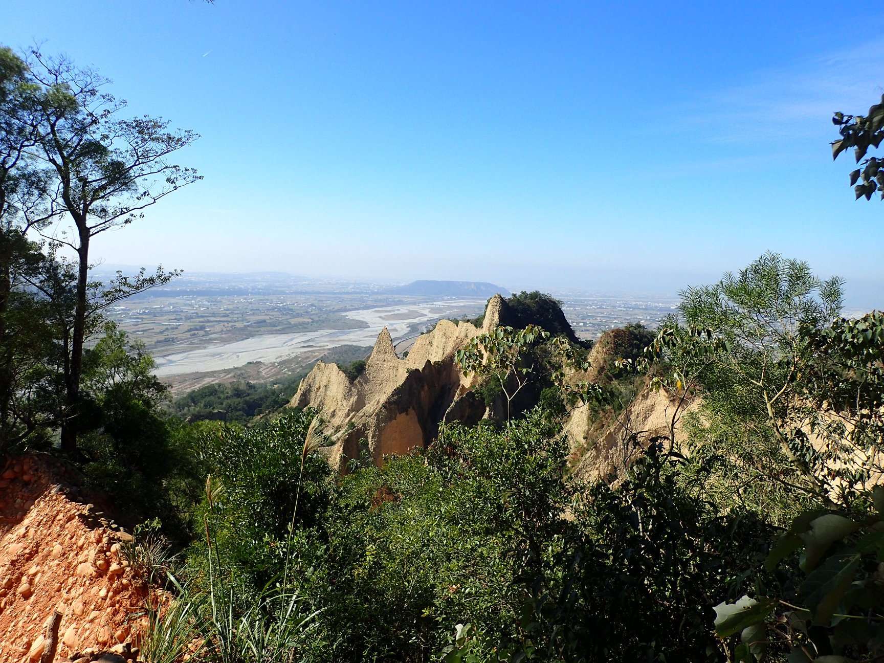
但因500公尺以下,剛好是「逆溫層」,每上升100公尺,非但沒有降0.6度C,愈往上爬,反而愈熱。從登山口到山頂的步道長約3km,距離雖不遠,但炎熱加上陡峭,感覺如爬「火山」,汗流浹背的程度,絕對不會輸給跑馬拉松的情形!
However, below 500 meters is considered temperature inversion. Every elevation of 100 meters makes you feel hotter instead of cooling down. The distance is about three kilometers from the hiking gate to the top of the mountain. Hot weather and the steep trail made us sweat.
火炎山這裡是礫石層。在中部地區三條重要河川,將高山崩落的岩石,經漫長河川的運輸,研磨成圓滑的礫石後,大量堆積在出山口的區域。大安溪的出山口是火炎山,大甲溪是頭嵙山,烏溪則是九九峰。這些出山口的區域,就是陡峭的山坡進入平緩地形的地方,這亦是50多萬年前的古海岸線。這些堆積的礫石層,之後再隨著造山運動抬升,及局部的地形作用,變成現今的樣貌。
Huoyanshan cosists of gravel terrance. In central Taiwan, three major rivers bring rocks collasping from high mountains; after a long journey, the rocks become smooth gravels, massively deposited in the river exit. The exit area of Da-an River is Huoyanshan, the exit area of Dajia River is Toukoshan, and the exit area of Wu River is Jiujiu Peak. The exit areas are where steep mountain goes to flat terrain, which is also the ancient coastline dated back 500,000 years ago. The accumulated gravel terrance elevated by orogeny and geomorphic process, becoming what it is today.
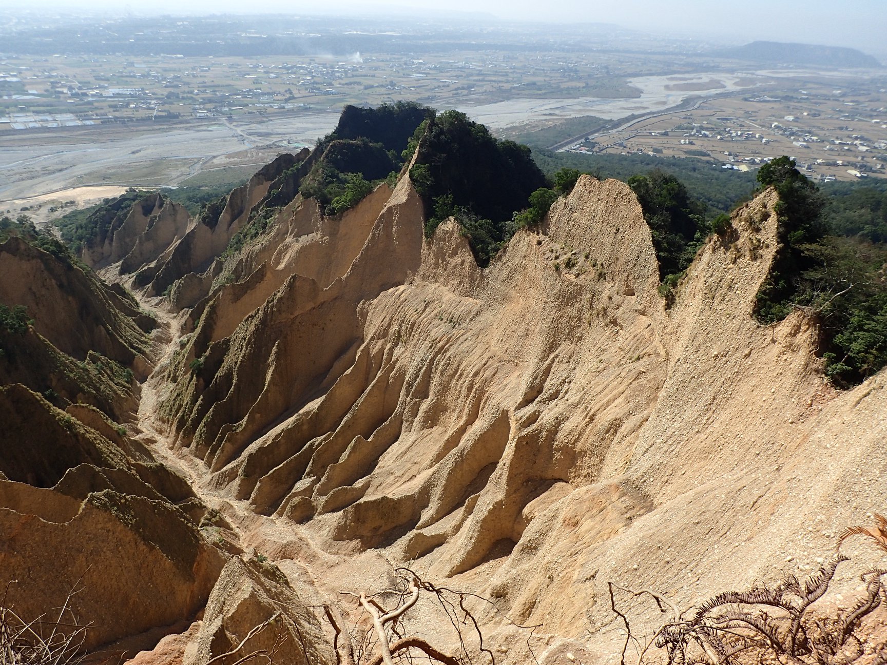
火炎山實景
由於火炎山與大肚山同樣是礫石層的地質結構,因此這裡的森林,對於大肚山天然林的復育,極具參考價值。大肚山目前僅殘存著非常小面積的天然林,如降真香、毬花嘉賜木的森林,其他臺灣低海拔常見的香楠、江某、青剛櫟等,在大肚山已完全不見蹤跡。
Huoyanshan and Mt. Dadu are both gravel terrance. Thus, the forest here can be of valuable reference. Mt. Dadu has a small amount of remaining natural forest such as Acronychia pedunculata and Casearia glomerata. Common lower altitudes plants such as Machilus zuihoensis, Schefflera octophylla and Cyclobalanopsis glauca aren’t seen in Mt. Dadu.
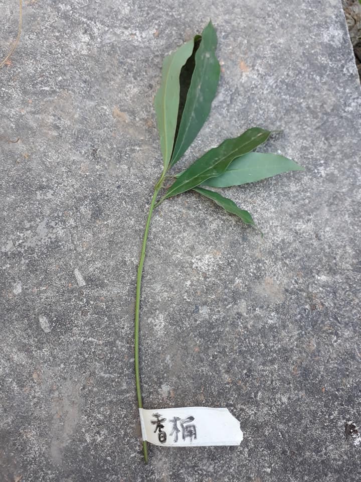
我們順著步道而上,約在0.9km的地方,海拔345m,拉設了一個20mx20m的樣區,這裡是「三斗石櫟─九節木」植物社會。換言之,過去的大肚山理應會有這樣的森林。此森林的結構與物種組成,詳如附件。
We hiked on the trail, and set a 20m by 20m sampling area located in 0.9k, at the height of 345meters. Here is the “Pasania hancei var. ternaticupula - Psychotria rubra” plant society. In other words, in the past Mt. Dadu are supposed to have a forest like this. The composite of the forest and species are as follows.
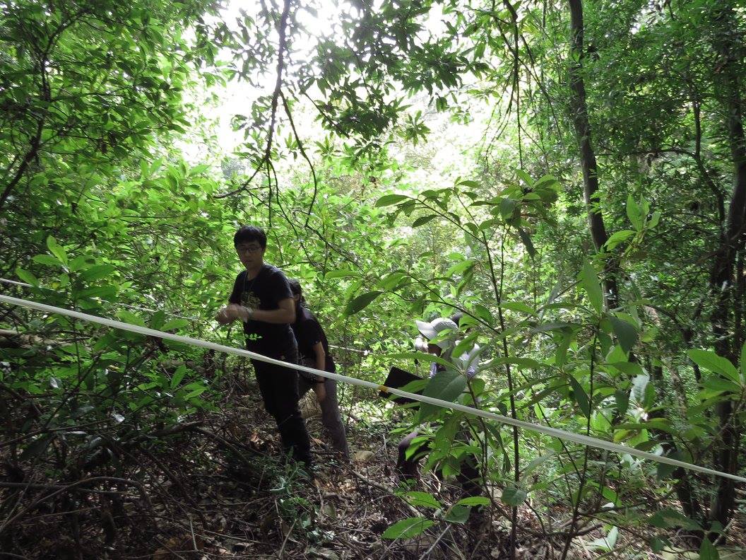
圍設樣區
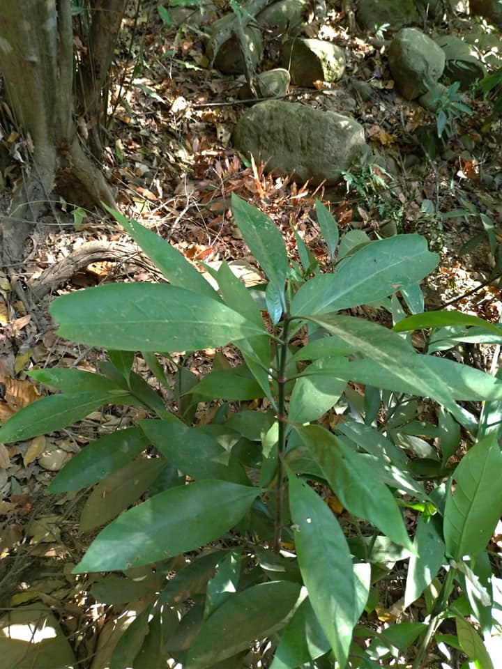
九節木
我們所謂的天然林,是指森林遭受開發或自然災害後,經演替恢復為極盛相的森林,此有別於次生林。
Natural forest is defined as an ultimately stable state forest through a chain of ecological succession after disruption or natural disaster, which differs from secondary forest.
次生林的樹木屬於陽性的植物,是先驅物種,在森林遭受破壞後,他們會先進來,他們可以忍受強烈的陽光,與貧瘠的環境,但成林後,在大樹枝葉的遮陰下,環境變為陰暗,由於他們的小苗需要強烈的陽光,因此這些小苗無法在自己的森林下生長,但這樣的環境,卻剛好適合天然林的耐陰物種的生長。
Trees considered as secondary forest are those of sun plants, which are pioneer species. They are the first to colonize previously disrupte environment, tolerating intense sunlight and harsh environment. After pioneer species develop to their fullest, their own seedlings can’t grow in the shady understory. However, the environment are ideal for shade-tolerant trees to grow.
次生林老化後,交棒給耐陰的樹木,再逐漸形成天然林。故天然林的物種大部分屬於耐陰的植物,這些樹木的小苗必須在陰暗的環境中,慢慢生長,他們在等老樹倒下後,接替補上森林的空缺與破洞。
As secondary forest age, shade tolerant plants start to take place, forming natural forest. Consequently, the majority of the natural forest species are shade plants. Their seedlings must endure the shade and grow, waiting for old trees to fall and take over the space.
因此天然林是陰暗的,且天然林中的優勢喬木,在林下一定有他們的小苗存在。如這片「三斗石櫟」的森林,老、中、青、少、幼兒,全部都有,這樣的年齡結構,也是森林之所以能「生生不息」的生命力!
As a consequence inside the natural forest is quite dark. The dominant arbor’s seedlings can be found on the forest floor. In the Pasania hancei var. ternaticupula forest, they can be seen at different ages, from tiny seedlings to teen-age, adult phase, and old age. The variation of age structure makes a forest full of life and last a long time.
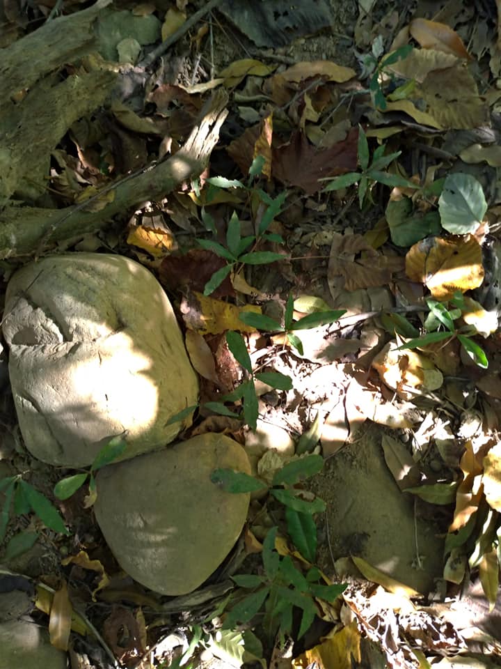
三斗石櫟-小苗
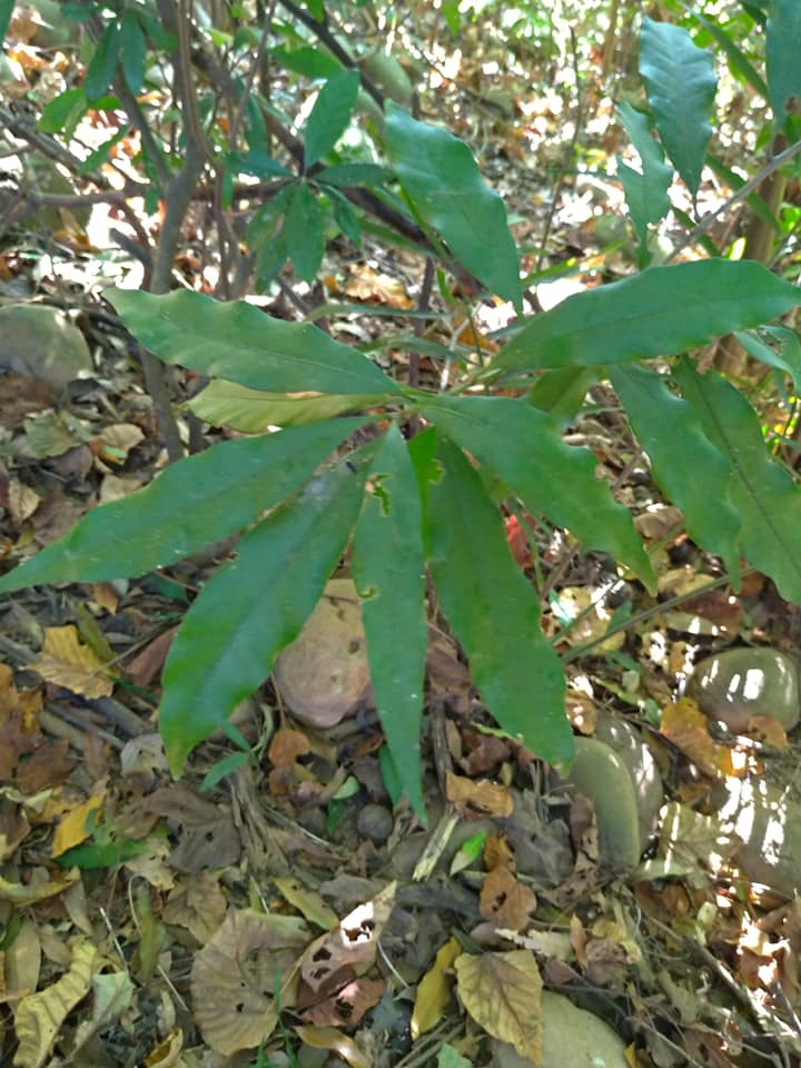
三斗石櫟
完成森林調查後,我們順著稜線上到火炎山頂,這裡的森林已轉變為「大頭茶優勢的森林」。
After the survey, we climbed along the ridge line to the top of Huoyanshan. The forest has tuned into a “Gordonia axillaris dominant forest”.
由於水往低處流的特性,在礫石層的環境,高度的效應,也形成水份的梯度,隨著高度的升高,土壤中的水份就愈少。水份的梯度是影響森林物種組成的主因之一,在火炎山頂或瘦稜上,大頭茶因能忍受水份少的乾旱環境,而勝出成為優勢的物種。這也意味著,在大肚山類似的環境,大頭茶是可能的天然林類型。
As water flowing downwards, in the gravel environment, the water content in soil decreases as the height elvevates. Water content is the main factor to affect species composition in a forest. On the top of Huoyanshan and the thin ridge, Gordonia axillaris can survive in an arid environment and become dominant species. That is to say, in a similar environment as Mt. DaDu, Gordonia axillaris could be the type of natural forest.
在稜線二側的崩塌區,也看到許多馬尾松。馬尾松是火炎山自然保留區保護的對象,在15年前因松材線蟲的肆虐,這裡的馬尾松有將近95%受感染死亡。當時不少人憂心此冰河孑遺的物種,就此滅絕!
In the landslide area on both side of the ridgeline, we saw many Pinus massoniana, which the reserve intend to protect. 15 years ago, due to a Outbreaks of pine wilt disease caused by Pine wood nematode (Bursaphelenchus xylophilus) , 95% of the Pinus massoniana were infectecd and died. Many people were worried whether the glacial relict species would disappear.
此次觀察,很高興看到這群馬尾松從大難中,熬了過來。面對這群馬尾松,心中充滿著崇敬,因為數萬年來,他們一直挺立在火炎山上,一代一代守護著這座山,心想我們是否也能像他們一樣,用一生來守護著臺灣這塊土地。
During the trip, we’re glad to learn that Pinus massoniana has survied the disaster. We have repects for the Pinus massoniana as they stand on Huoyanshan for tens of thousands of years and guard the mountain for generations. We wonder if we can protect the land of Taiwan as Pinus massoniana through our lives.
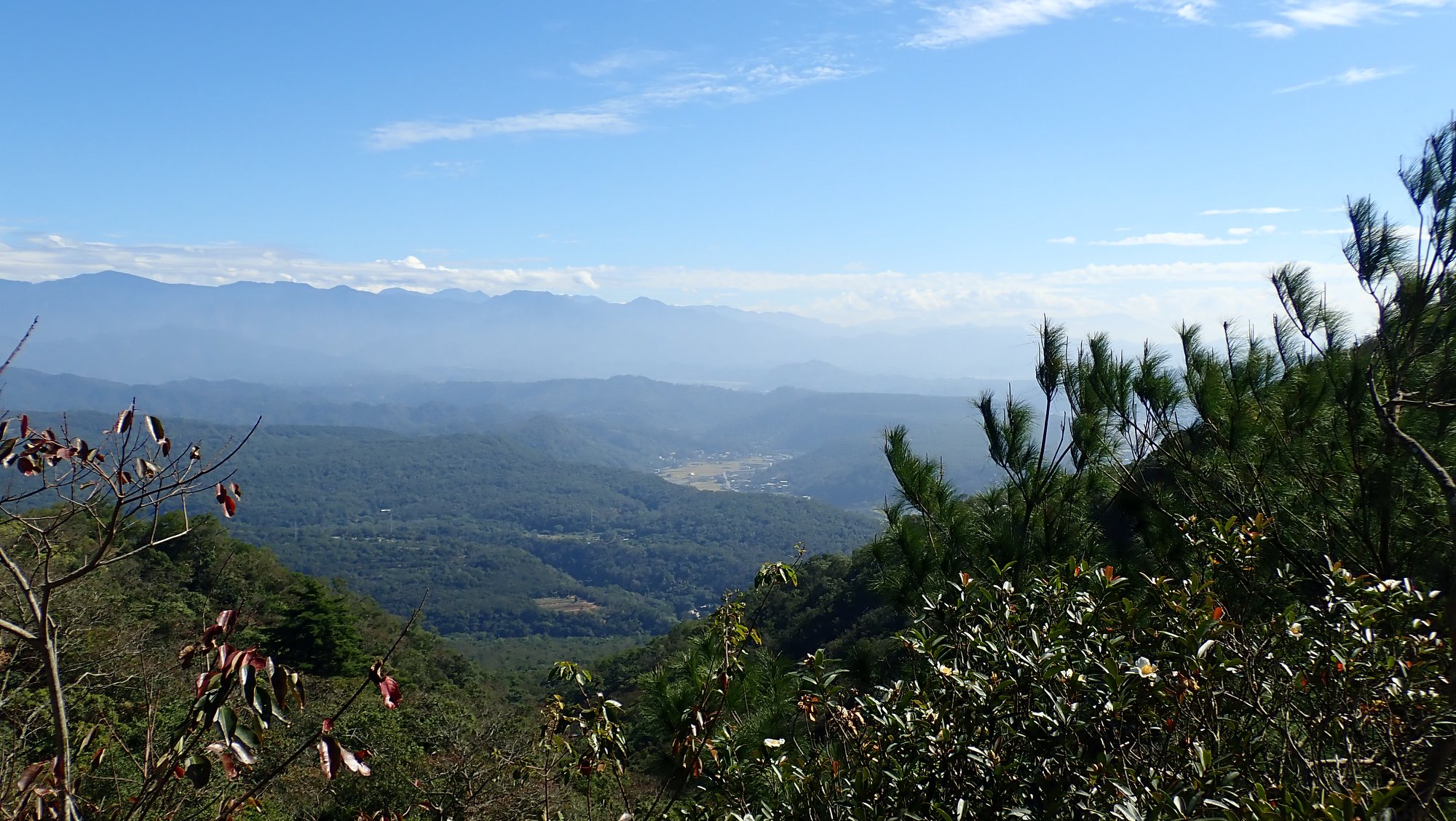
從山頂的回程,我們從東側的緩坡下山,此路段在10年前有部分區域被砍伐,印象中,有一段路是沒有樹蔭的。但沒想到10年後,這裡居然已演替成茂密的森林。這段路,也見證了臺灣的森林自癒的能力很強,只要不被刨根摧毀,只要有種源,森林就可以很快復原。
Climbing down the mountain on the gentle slope in the east side, I remember trees in some parts of the area were cut down and there was an area with no shade at all. Surprisingly, after ten years, a beautiful forest flourish in the area through natural succession. The part of the path proves that forest recovers from disruption, as long as they keep the seeds alive.
此次行程,所有參加的夥伴都累到直呼印象深刻。雖然疲累,但每個人卻異口同聲地說,留在心中的,都是美麗的森林與大自然的美景。
The hiking trip certainly tired all participants. Though feeling tired, everyone said they can always recall the scenes of beautiful forest and the moments in nature.
而這樣美的收穫,雖然辛苦,但真的很值得!
The beauty of nature to be our rewards, it’s absolutely worth the trip.
【致謝】
此次活動感謝東海大學陳明石教授團隊共同參與,也感謝常務理事陳欣一用心帶領植物的調查與野外辨識。過程中,謝謝楊勝崴幫忙背負器材及標本,謝謝黃香容老師協助樣區調查的記錄,也謝謝林育臣醫師幫忙採集標本,謝謝吳晴瑋、吳明書進行植物攝影記錄。沿途中,謝謝所有協助秦佳妘的夥伴,讓她完成全程的壯舉。也謝謝林妍廷協助報到的行政工作,謝謝林慧玉、白環禎協助活動攝影記錄。更謝謝此次參與的夥伴,你們辛苦了。
9/24這天也是白環禎的生日,我們一起祝福她生日快樂。
<Special Thanks to …..>
We want to give special thanks to Professor Ming-Shih Chen atDonghai University and his team to participate, also thank executive council member Hsin Yi Chen for guiding plant survey, Shiang Rong Huang for taking notes in the survey. We want to thank the members who assisted admintration work, and thank everyone for your participation.
Today September 24th is Huan Chen Bai’s birthday, we wish her happy birthday.
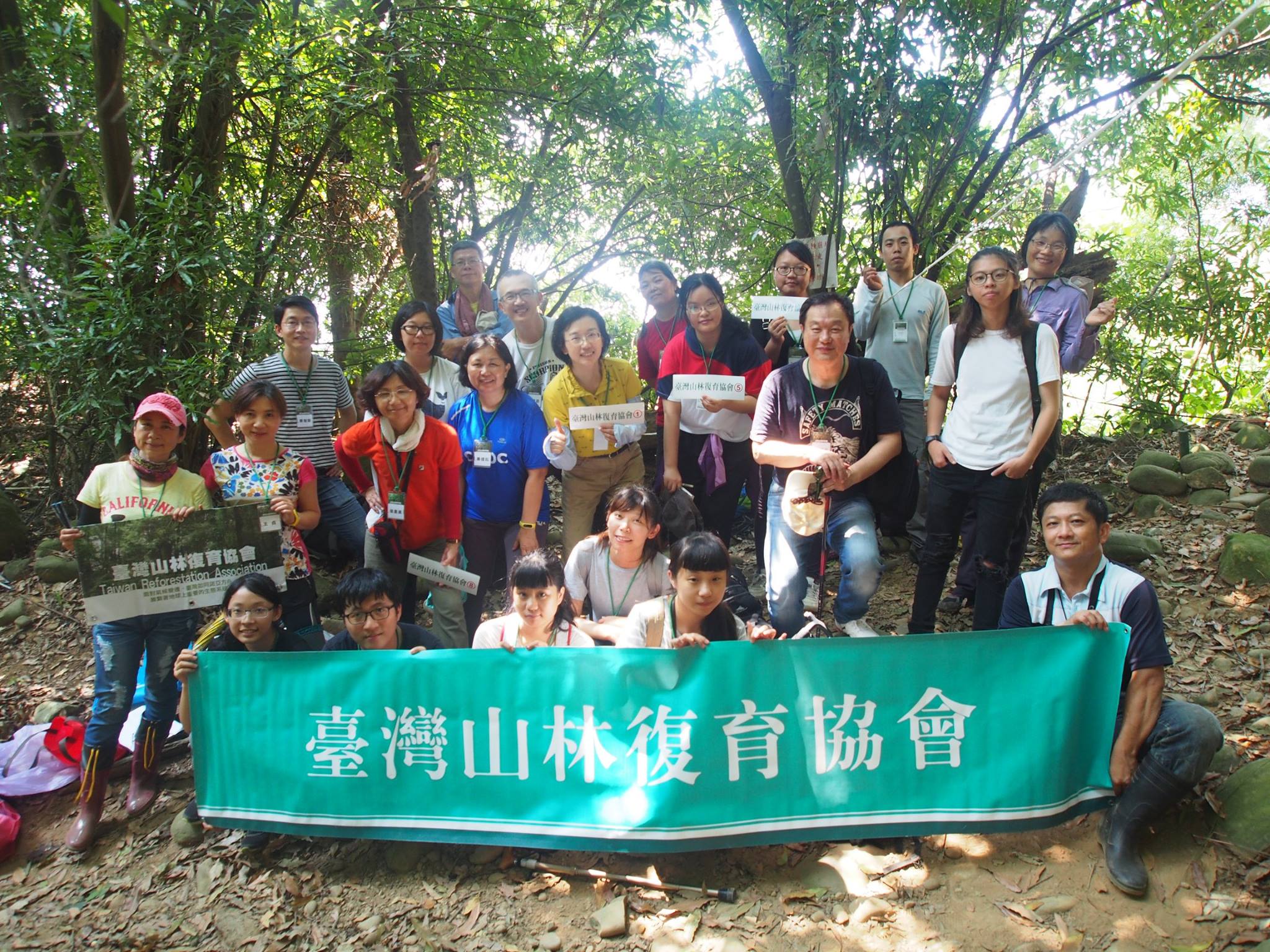
大合照
附件:
臺灣山林復育協會《三義火炎山生態調查》
Taiwan Reforestation Association
《Huoyanshan 》Ecological Survey
日期:2017/9/25
Date: 2017/9/25
地點:火炎山步道0.9km
Site Name: Huoyanshan trail
植物社會:三斗石櫟─九節木
Plant Society: Pasania hancei var. ternaticupula- Psychotria rubra
坡度15°;坡向0°
Slope 15°; Slope Direction 0°
海拔高度:345m
Height Above Sea Level: 345m
樣區面積:20m×20m
Sample Area: 20m×20m
座標:222639, 2695122
Coordinate: 222639, 2695122
備註:
調查:陳欣一;紀錄:黃香容
Surveyor: Hsin Yi Chen; Notetaker: Shiang Rong Huang
~T樹冠層,高度17米,覆蓋度60%~
T1 Upper Tree Layer, Height 17 m, Range of Cover 60%
廣東油桐( 3,1)【5株】、三斗石櫟(3,3)【13株】、白匏子(1,+)【2株】、香楠(2,+)【2株】、樹杞(1,+)【2株】、沙朴(1,+)【1株】、小梗木薑子(1,+)【2株】
Aleurites montana(3,1) , 5 in total
Pasania hancei var. ternaticupula(3,3), 13 in total
Mallotus paniculatus(1,+) , 2 in total
Machilus zuihoensis(2,+) , 2 in total
Ardisia sieboldii(1,+) ,2 in total
Celtis sinensis(1,+), 1 in total
Litsea hypophaea(1,+), 2 in total
~ S灌木層,高度6m,覆蓋度45%~
Shrub Layer, Height 6m, Range of Cover 45%
三斗石櫟( 1,1)、小梗木薑子( 1,+)、九節木(1,2)、樹杞( 1,+)、香楠( 1,1)、千金藤( +,1)、三葉崖爬藤( +,+)、三角葉西番蓮( +,+)、葛藤( +,1)
Pasania hancei var. ternaticupula( 1,1), Litsea hypophaea( 1,+), Psychotria rubra(1,2), Ardisia sieboldii( 1,+), Machilus zuihoensis( 1,1), Stephania japonica( +,1), Tetrastigma formosanum( +,+), Passiflora suberosa( +,+), Pueraria lobata ssp. thomsonii( +,1)
~H地被層,高度2m,覆蓋度65%~
H: herbaceous layer, Height 2m, Range of Cover 65%
三斗石櫟( 1,2)、廣東油桐(+,1)、小梗木薑子( +,1)、九節木( 2,3)、鬼紫珠(1,2)、沿階草( +,1)、臺灣山桂花(+,1)、野棉花(+,1)、大錦蘭(+,1)、樹杞(+,1)、香楠(+,1)、藤竹草(1,2)、五節芒(+,2)、熱帶鱗蓋蕨(+,1)、斜方複葉耳蕨(2,2)、半邊羽裂鳳尾蕨(1,2)、槭葉牽牛(+,1)、三角葉西番蓮(+,1)、千金藤(+,1)、葛藤(+,1)、羊角藤(+,1)、紅仔珠(+,+)、印度牛膝(+,1)、弓果黍(+,2)、金午時花(+,1)、距花黍(+,1)、龍眼(+,+)、白匏子(+,1)、山棕(+,+)、樟樹(+,+)、大葉楠(+,1)、大葉鳳尾蕨(+,+)、杜虹花(+,1)、月桃(+,2)、臺灣土茯苓(+,1)、風藤(+,2)、華九頭獅子草(+,1)、南五味子(+,1)、青牛膽(+,1)、薄葉野山藥(+,+)、粗毛鱗蓋蕨(+,2)、海洲常山(+,+)、白臼(+,+)、土密樹(+,1)、小葉桑(+,+)、扛香藤(+,+)、燈稱花(+,+)、月橘(+,+)、山素英(+,+)、海金沙(+,+)、平柄菝契(+,+)、相思樹(+,+)
Pasania hancei var. ternaticupula ( 1,2), Aleurites montana (+,1), Litsea hypophaea ( +,1), Psychotria rubra( 2,3), Callicarpa kochiana(1,2), Ophiopogon intermedius( +,1), Maesa perlaria var. formosana(+,1), Urena lobata(+,1), Anodendron benthamiana(+,1), Ardisia sieboldii(+,1), Machilus zuihoensis(+,1), Panicum sarmentosum(1,2), Miscanthus floridulus(+,2), Microlepia speluncae(+,1), Arachniodes rhomboides(2,2), Pteris semipinnata(1,2), Ipomoea cairica(+,1), Passiflora suberosa(+,1), Stephania japonica(+,1), Pueraria lobata ssp. thomsonii(+,1), Gymnema sylvestre(+,1), Breynia officinalis(+,+),Achyranthes aspera var. indica(+,1), Cyrtococcum patens(+,2), Sida rhombifolia(+,1), Ichnanthus vicinus(+,1), Euphoria longana(+,+),Mallotus paniculatus(+,1), Arenga engleri(+,+),Cinnamomum camphora(+,+),Machilus japonica var. kusanoi(+,1), Pteris cretica(+,+),Callicarpa formosana(+,1), Alpinia zerumbet(+,2), Smilax lanceifolia(+,1), Piper kadsura(+,2), Dicliptera chinensis(+,1), Kadsura japonica(+,1), Thladiantha nudiflora(+,1), Dioscorea japonica(+,+),Microlepia strigosa(+,2), Clerodendrum trichotomum(+,+),Sapium discolor(+,+),Bridelia tomentosa(+,1), Morus australis(+,+),Mallotus repandus(+,+), Ilex asprella(+,+),Murraya paniculata(+,+),Jasminum nervosum(+,+),Lygodium japonicum(+,+),Heterosmilax japonica, Acacia confusa(+,+)
-————————–
※改良式Braun-Blanquet調查法:
Improved Braun-Blanquet cover-abundance scale Survey Method:
調查時記錄植被的層次、分層高度、各層次總覆蓋度、各層次組成物種之覆蓋度與群聚度。
Record plant levels, height in each level, range of cover in each level, range of cover and abundance rating of each composite in each level
覆蓋度:
Range of Cover:
+,0~3%
1,3~10%
2,10~25%
3,25~50%
4,50~75%
5,75~100%
群聚度:
Abundance Rating:
+,出現1~2株
+, 1-2 individuals
1,零星分散
1, sparse
2,普遍分布或小塊群聚分布
2, small grouping
3,中等群聚分布
3, moderate grouping
4,大塊群聚分布
4, large grouping
5,全面分布
5, Large overall grouping
「真诚赞赏,手留余香」
真诚赞赏,手留余香
使用微信扫描二维码完成支付
